The User Defined Attributes relate to the Segment Types and Surface Types described above in the Knowledge Base section.
Attribute sets intended for Segments contain information that relates to the entire segment, whereas attribute sets intended for Surfaces of Segments contain information relating only to the surfaces. For example, attribute sets for surfaces will have entries in the condition area, whereas attributes sets for segments have none. Attribute sets for segments can have entries for the road name and ownership.
If RSM is installed alongside Conquest, all the Asset Types and Attribute Sets are created or amended in Conquest.
If RSM is installed as a standalone product, the Asset Types and Attribute Sets are created and amended in RSM.
•The Condition Lists section allows creation and definition of the condition lists that must be selected in the User Defined Attributes (see under Condition Lists below).
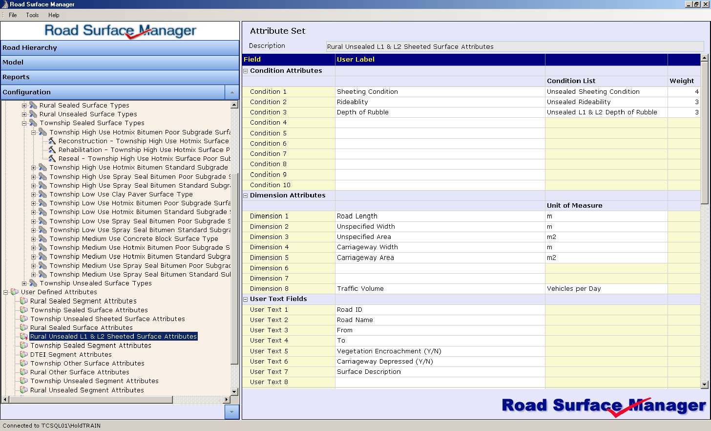
Shown below is a possible attribute set for a rural unsealed surface Asset Type.
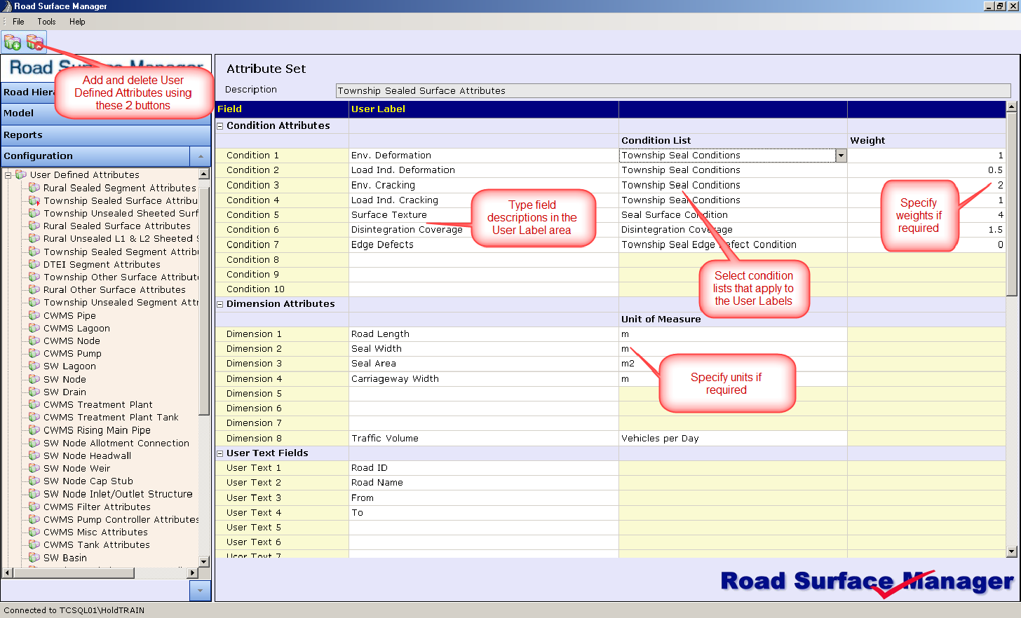
Condition Attributes
Condition Attributes are generally used for the Road Surface Asset Types. The Condition Attribute fields are list fields, which allow predefined drop lists to appear from where the user select from one of the options on the list. These lists and associated options are defined in the Code Editor explained further below in this document.
An example of condition attribute list fields are shown below.
The User Label is used to describe the field and will appear on the asset form e.g. Deformation, Binder Age, Aggregate, Texture, Stripping etc.
The entry in the Condition List column refer to a predefined list, titled ‘Condition’ in the Code Editor’s Condition List section. The list and its options will be described in the Code Editor sector further below.
Each Condition attribute is assigned a weighting. The weighting differentiates the various road surface types during modelling to prioritise maintenance. For example, a heavily trafficked road (e.g. Urban Seal – Major) could assign a higher weight to load-induced cracking and deformation than a more lightly trafficked road (e.g. Urban Seal – Local), where surface condition would have a higher weight. This flexibility allows the Roads Manager to set the key contributing factors that trigger maintenance intervention, which elevates the priority of roads as desired.
The weightings can be any range of numbers e.g. 1-5, 1-10, 1-100 etc.
For each Asset Type a separate set of weightings can be assigned to each defect (condition attribute). For instance, heavy traffic roads may weight load induced cracking as high, whereas for the local streets, the surface condition may be weighted higher due to environmental factors. The weightings are strategic tools for the Road Manager.
•Condition Attribute examples for Urban Seal Surface:
•Deformation (Environmental)
•Deformation (Load Induced)
•Cracking (Environmental)
•Cracking (Load Induced)
•Surface
•Disintegration
•Edge Defect
Condition Attribute examples for Rural Seal Surface
•Deformation
•Binder Age
•Edge Defect
•Texture
•Aggregate
•Stripping
•Cracking
•Patching
Condition Attribute examples for Unsealed Surface
•Sheeting Condition (for sheeted roads)
•Natural Formation Condition (for natural formation roads)
•Rideability
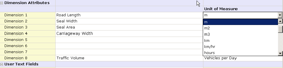
Dimension Attributes
The Dimension Attributes are applied to both the road segment and road surface Asset Types. The RSM uses Dimension 3 for Area in its reporting on the modelling.
The User label is used to describe the field e.g. Length, Seal Width, Seal Area.
The Unit of Measure records the units used for each dimension (e.g. m, m and m2). If RSM is a standalone installation, the available units appear in a drop list as shown below.
User Text Fields
The User Text fields allow recording of additional text information for the segment or the road surface Asset Type.
The User Label is used to describe the field e.g. From, To, Suburb, Ward left, Ward Right.
User Number Fields
The User Number fields allow recording of numerical values for the segment or the road surface Asset Type.
The User Label describes the field, e.g. Traffic count, Start chainage, End chainage.
User Date Fields
The User Date fields allow recording of date values for the segment or the road surface Asset Types.
The User Label describes the field, e.g. Inspection Date, Last Surfacing Date.
User Check Fields
The User Check fields allow recording of true/false values for the segment or the road surface Asset Types.
The User Label describes the field, e.g. Has painted lines, Bicycle Route.
User List Fields
The User List fields allow predefined drop lists to appear from where the user select from one of the options. These fields are used on the segment or the road surface Asset Types. These lists and associated options are defined in the Code Editor described further below in this document.
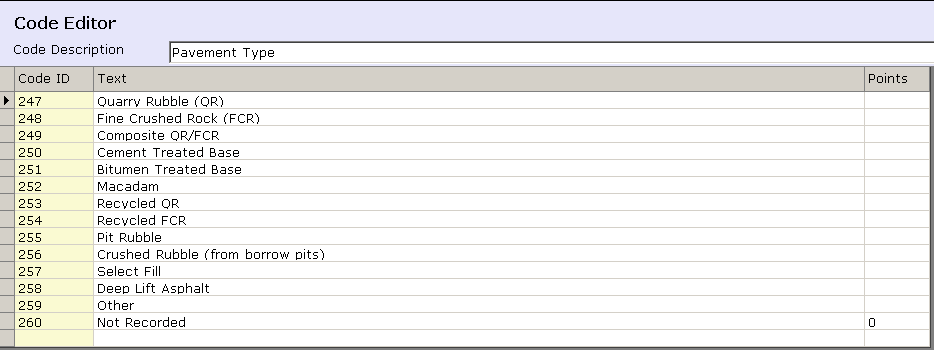
The User Label Describes the field, e.g. Surface Type. In this case, the text forming the label is chosen from the available lists in the drop down list (for standalone installations of RSM 2). These lists are in the Code Editor’s User List section, see example of available user lists below.
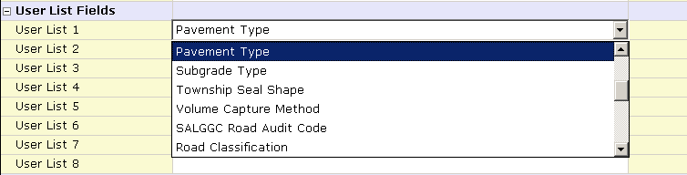
The options for the list, titled ‘Pavement Type’ are shown below.